Vision Map
The Great Smoky Mountains Regional Greenway Council has developed a Knoxville to the Smokies Vision Map. It's designed to help guide planning of a greenway trail from Knoxville to the edge of the Great Smoky Mountains. Help us make the vision a reality by spreading the word!
Tennessee River/French Broad Blueways Map
Updates to the Blueways Map
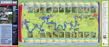
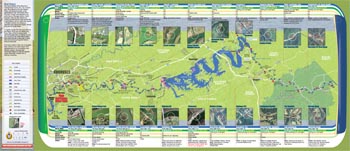
The Great Smoky Mountains Regional Greenways Council and its partners created the Blueways Map for the Tennessee and French Broad Rivers showing put-in and take-out locations for paddlers from the Fort Loudon Dam to the Tennessee/North Carolina border.
To request hard copies of the Blueways Map, please fill out and submit this form.
The west half of the map goes from Fort Loudon Dam to Volunteer Landing in downtown Knoxville.
The east half of the map goes from Volunteer Landing in downtown Knoxville to Cherokee National Forest.
Updates to the Blueways Map
- The Forks of the River access point shown on the map is now closed to the public.
- The Highway 66 access point to the French Broad River is now open, after several years of being temporarily closed because of nearby road construction.
Tennessee Valley Water Trails
TVA and Tennessee State Parks have a website with maps of several blueways in East Tennessee (and Middle Tennessee and West Tennessee too). They include the Little River Blueway in Blount County, and the Tellico River Blueway, on the edge of the Cherokee National Forest.


